 to Inventory Public Facilities and Residential Areas in Kahyapu Village, Enggano Island")
Community Service Activity: Utilizes Geographic Information System (GIS) to Inventory Public Facilities and Residential Areas in Kahyapu Village, Enggano Island
Kahyapu Village in the Pulau Enggano Subdistrict, North Bengkulu Regency, Bengkulu Province recently conducted a community service activity aimed at utilizing Geographic Information System (GIS) in the inventorying of public facilities and residential areas. Through the use of GIS, it is hoped that an informative profile of Kahyapu Village can be compiled, covering aspects of social, cultural, religious, health, service quality, and community life. This explanation will provide an overview of the positive impact of utilizing GIS in improving the lives of the community in Kahyapu Village.
The activity was carried out by a self-reliant community service team consisting of Akbar Abdurrahman Mahfudz, S.Si., M.Sc as coordinator, Ana Ariasari, S.Pi., M.Sc, Ayub Sugara, S.Kel. M.Si, and Ari Anggoro, S.Pi., M.Si as members, along with Wisnu Aditya, a student who participated as a member. The activity took place from May 27th to May 30th, 2023, in Kahyapu Village.
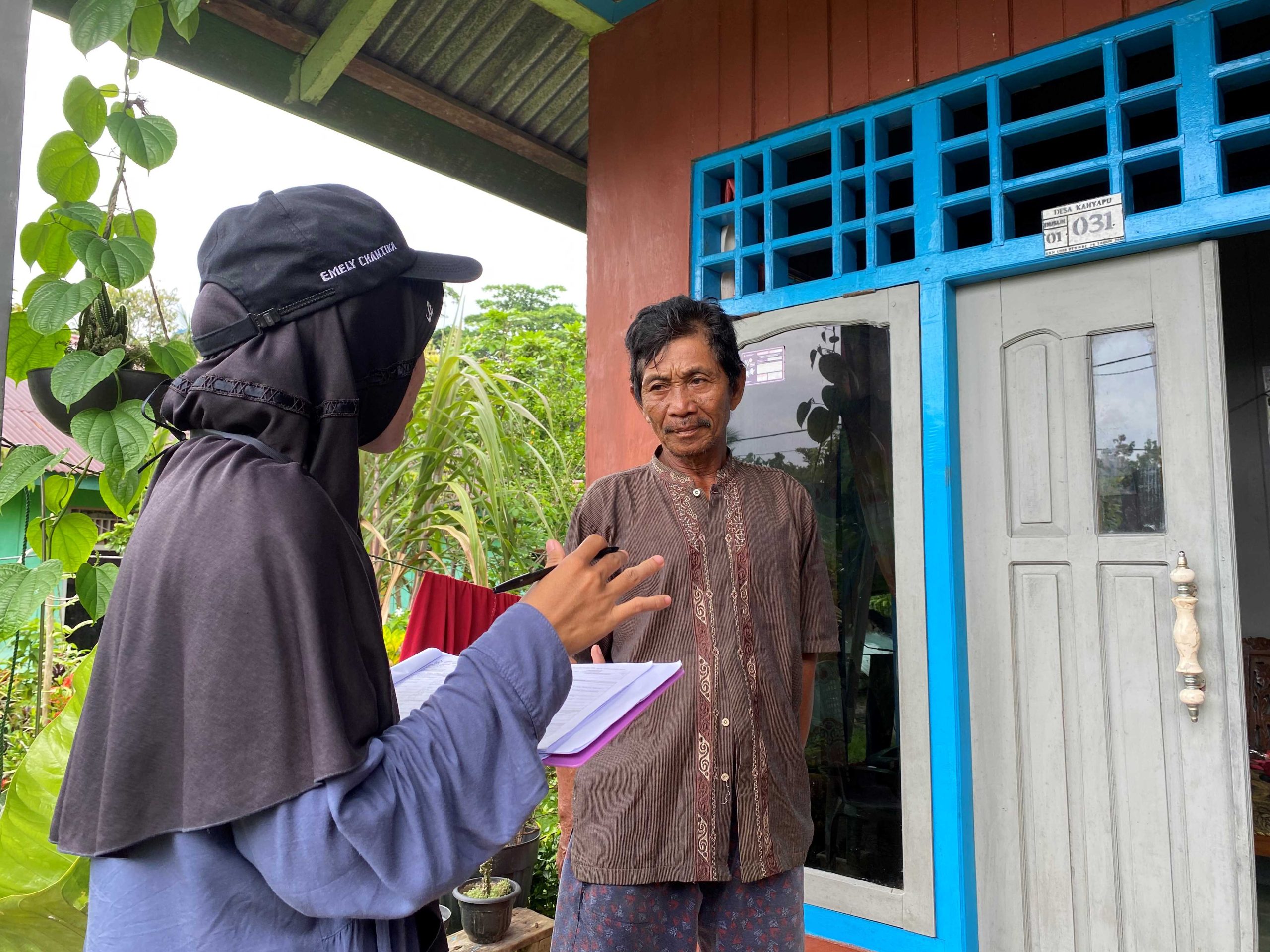
Interviews and field surveys were conducted in Kahyapu Village during May 27th to May 30th, 2023. Additionally, a socialization event was held on May 28th, 2023, at the Kahyapu Village Hall. The purpose of the interviews and field surveys was to gather data on the inventory of public facilities and residential areas in Kahyapu Village. The activities began with equipment preparation, including field survey maps, GPS devices, cameras, survey forms, and writing tools. The next step was a pre-field activity to provide a brief training on GPS usage and survey form completion.
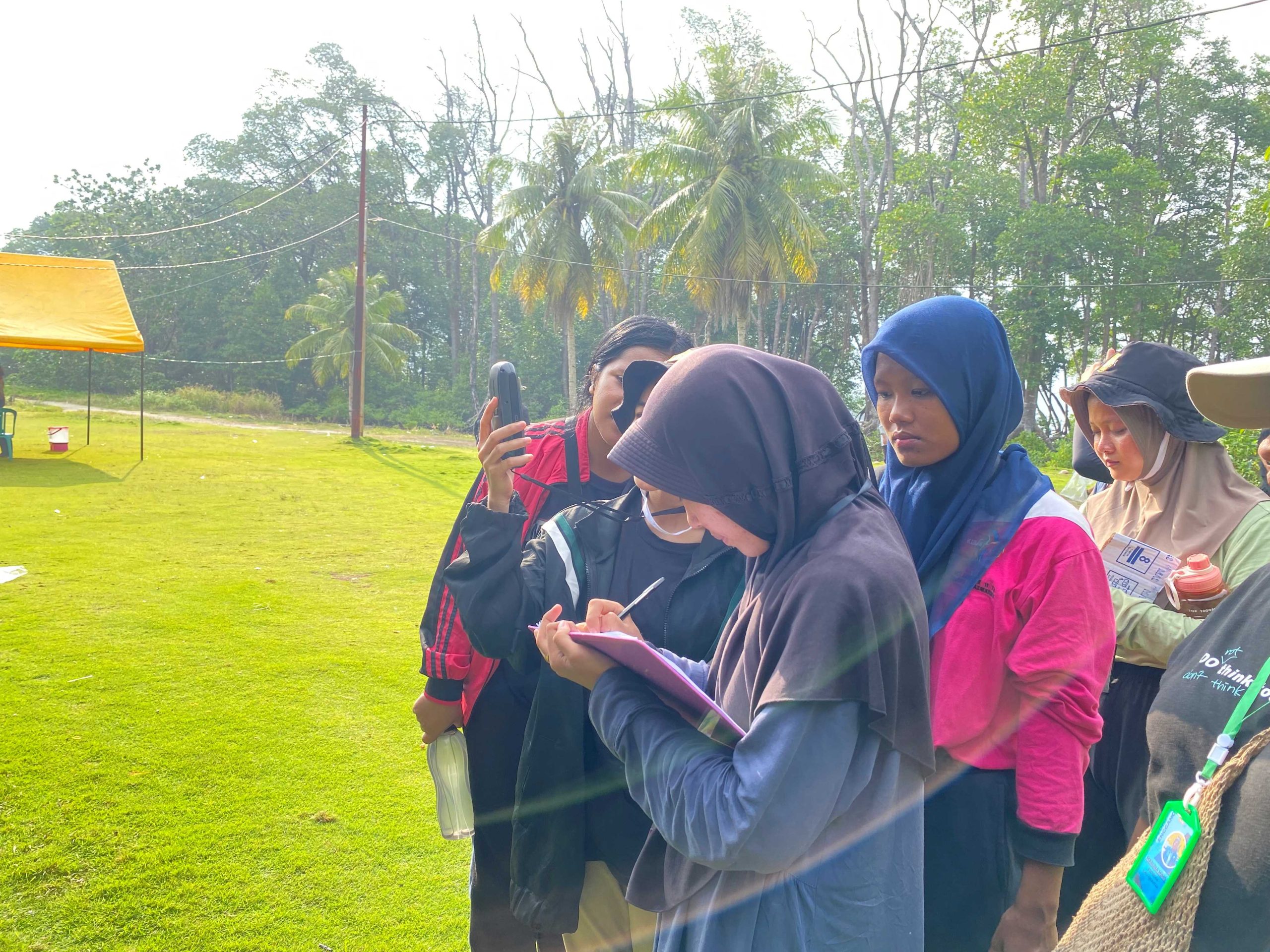
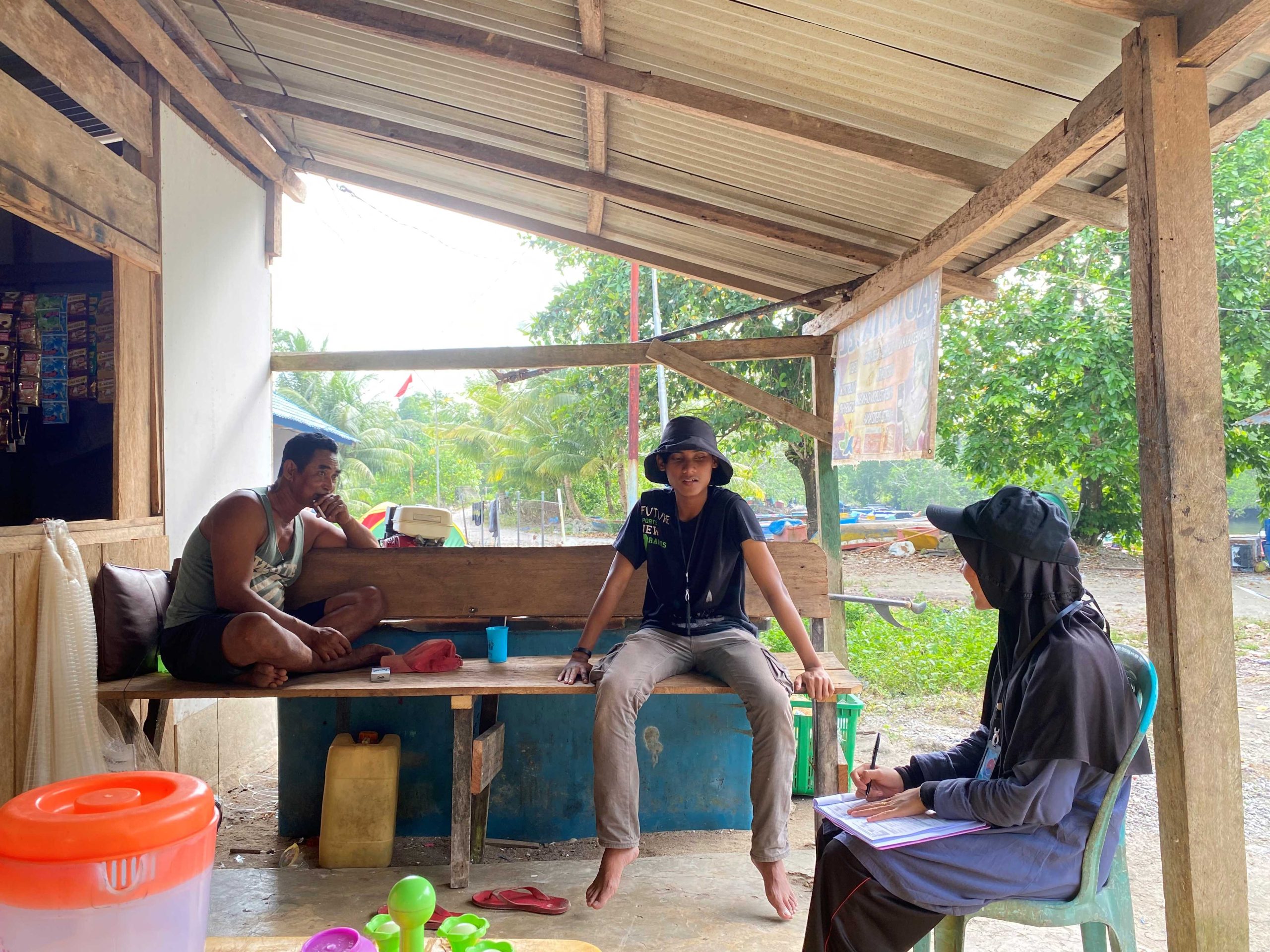
The field survey activities on the first day focused on inventorying and interviewing the locations of public facilities and residential areas near the accommodation/base camp, specifically the areas around Kahyapu Village’s harbor. On the second day, the field survey focused on inventorying locations near the main road access. Finally, on the third day, the field survey covered locations that had not been visited yet, particularly areas far from the main road access. Over the course of three days, the field survey and interviews successfully documented nearly 200 buildings in Kahyapu Village, including both public facilities and residential areas.
The socialization event took place on May 28th, 2023, at the Kahyapu Village Hall. The necessary preparations included providing printed maps displaying the village’s geospatial information. The team also coordinated with the village head to gather community members, including representatives from the village administration, community leaders, fishermen groups, village tourism groups, and the general public. The opportunity provided by the socialization event was used to introduce the concept and benefits of using GIS to the village community. The socialization was conducted through direct meetings with the villagers, where the basic concepts of GIS, spatial data collection, and their benefits in inventorying public facilities and residential areas were explained.
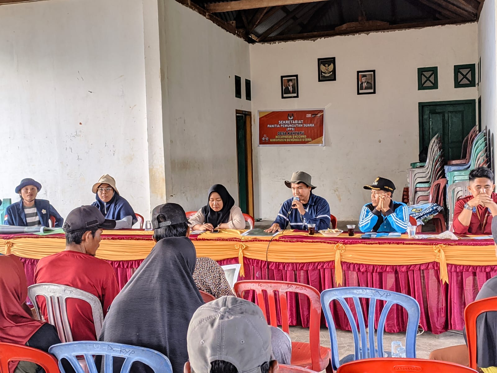
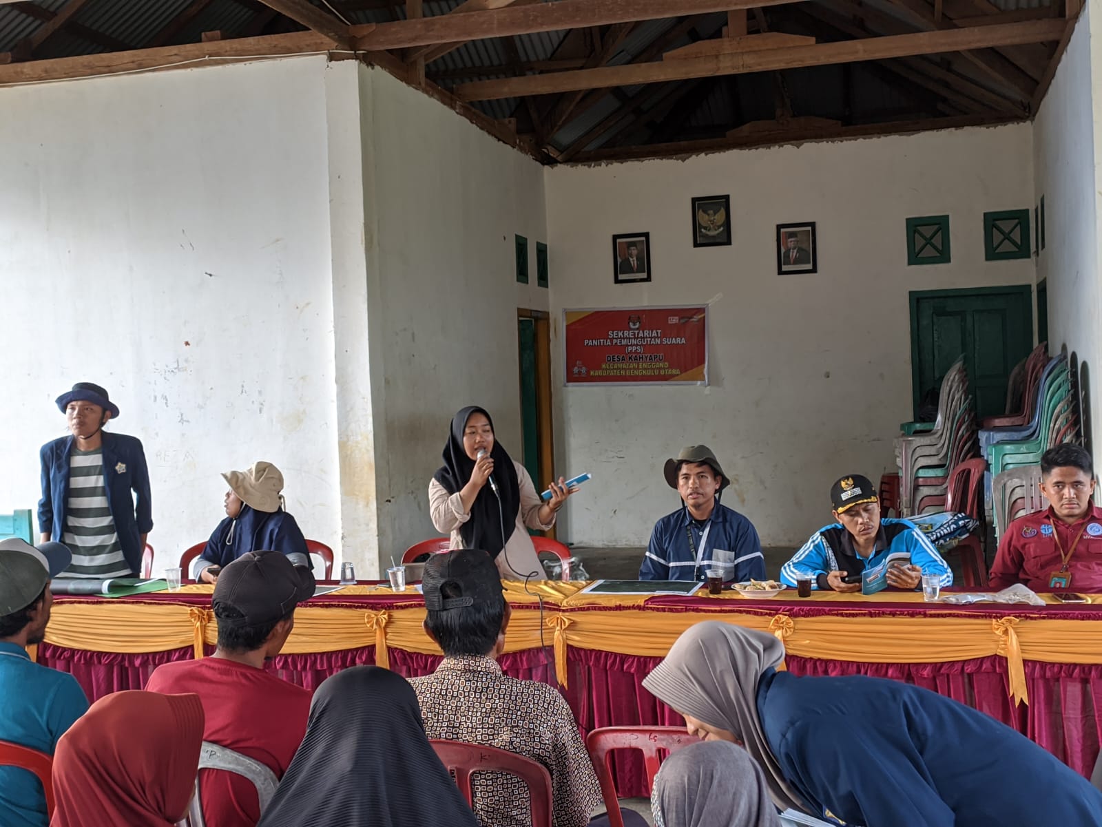
An evaluation of the activity was conducted by distributing questionnaires after the community service activity, allowing participants to rate each statement on a scale of 1 (very poor) to 5 (excellent). The evaluation results indicated excellent ratings based on the recapitulation of the evaluation questionnaires. Some evaluation points that were asked and received an overwhelmingly excellent rating included the delivered socialization and simulation materials, the presentation style of the presenters, the duration of the material presentation, the community service activities addressing community issues, interest, usefulness, and satisfaction with the community service activities, the sustainability of the community service activities, and the level of response to questions and suggestions during the community service implementation.
The community service activity titled “Utilizing Geographic Information System (GIS) in Inventorying Public Facilities and Residential Areas to Enhance the Informative Profile of Kahyapu Village” aimed to use GIS technology to gather data on public facilities and residential areas in Kahyapu Village. Through the use of GIS, this activity successfully produced a more comprehensive and informative village profile.
Recommendations:
- Continuing the development of the village profile: After the inventorying activity using GIS is completed, it is important to continue developing and updating the village profile periodically. This ensures that the data presented in the village profile remains relevant and accurate.
- Expanding the use of GIS: Besides inventorying public facilities and residential areas, GIS can also be used for other beneficial activities in Kahyapu Village. For example, it can be used for mapping natural resources, analyzing disaster risks, or developing infrastructure.
- Training on GIS usage: To maximize the benefits of GIS in inventorying and mapping, it is recommended to provide training to the members of Kahyapu Village. This training will help residents understand and effectively use GIS technology, allowing them to be involved in maintaining and developing the village profile.
- Collaboration with the local government: Kahyapu Village can collaborate with the local government regarding the use of GIS. Collaboration can facilitate broader data exchange and expand the coverage of inventorying public facilities and mapping residential areas.
- Utilizing the inventorying results: The data obtained from the inventorying activity using GIS can be used as a basis for better village planning and decision-making. It is recommended that Kahyapu Village actively integrate this data into the village development process, considering sustainability and community well-being.
By implementing these recommendations, Kahyapu Village can maximize the utilization of GIS in inventorying public facilities and mapping residential areas, thus enhancing the completeness of an informative village profile and providing greater benefits to the community.
Furthermore, the recommendations provided will contribute to the long-term development and progress of Kahyapu Village.
- Continuing the development of the village profile: The village profile serves as a valuable resource for various stakeholders, including government agencies, NGOs, and potential investors. By regularly updating and expanding the village profile, Kahyapu Village can showcase its progress and attract more opportunities for development and collaboration.
- Promoting the use of GIS in neighboring villages: Kahyapu Village can share its successful experience in utilizing GIS with neighboring villages. This can be achieved through workshops, seminars, or knowledge-sharing sessions, where the benefits and methodologies of using GIS can be explained. By doing so, Kahyapu Village can inspire and support the implementation of GIS in other communities, contributing to regional development as a whole.
- Strengthening partnerships with academic institutions: Collaborating with universities and research institutions can bring additional expertise and resources to Kahyapu Village’s efforts in utilizing GIS. This collaboration can involve student internships, joint research projects, or knowledge transfer initiatives. Academic institutions can provide technical assistance, data analysis expertise, and innovative ideas to further enhance the utilization of GIS in the village.
- Integrating GIS into local governance processes: Kahyapu Village can work closely with the local government to integrate GIS into decision-making processes. By incorporating GIS data into development plans, infrastructure projects, and resource management strategies, the village can ensure more efficient and evidence-based decision-making. This collaboration will strengthen the village’s capacity to leverage GIS technology for sustainable development.
- Monitoring and evaluation of the impact: To assess the effectiveness of utilizing GIS in improving the lives of the community, regular monitoring and evaluation should be conducted. By measuring key indicators such as access to public facilities, infrastructure development, and community satisfaction, Kahyapu Village can continuously assess the impact of GIS implementation and make necessary adjustments to maximize its benefits.
Through the implementation of these recommendations, Kahyapu Village can establish itself as a model for utilizing GIS technology in rural development. The comprehensive village profile, along with continued collaboration and knowledge-sharing, will contribute to the overall advancement and well-being of the community. With a strong commitment to leveraging GIS, Kahyapu Village can embrace the opportunities and challenges of the digital era, paving the way for a prosperous and sustainable future.
News Contributor: Akbar Abdurrahman Mahfudz


