
Empowering Rural Tourism through Geospatial Information: A Step towards Sustainable Development
Desa Kemumu, a village rich in natural resources, is on its way to becoming a promising tourist destination, boasting attractions like Kemumu Waterfall and terraced rice fields. Despite its potential, the village faces challenges in optimizing its 3A-based tourism development—attractions, accessibility, and amenities. Recognizing this, the community is taking a step forward with a participatory mapping initiative.
With a population of 2,617 (BPS, 2021), Desa Kemumu stands out in Kecamatan Arma Jaya. Capitalizing on its human resources potential, the village aims to develop educational tourism (edu-tourism). However, the lack of comprehensive information on attractions, amenities, and accessibility hinders progress. To tackle this, a community engagement effort is underway.
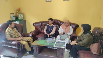
Led by a team of experts, the initiative focuses on enhancing local capacity in participatory mapping and geospatial information. The objective is to introduce geospatial information in the form of participatory mapping to the Pokdarwis Argatirta Kemumu, a local community tourism group. By doing so, the project aims to empower the village in terms of resource management and decision-making.
The initiative aligns with the village’s pursuit of sustainable development. Geospatial information plays a vital role in policymaking, decision-making, and activities related to regional planning. It aids in economic, social, cultural, and national security sectors. The utilization of geospatial information has strategic implications, such as boundary delineation and disaster mitigation.
Geospatial information is divided into basic geospatial information (IGD) and thematic geospatial information (IGT). IGD provides foundational data, while IGT covers various topics like forestry, agriculture, and fisheries. Leveraging this data, the participatory mapping approach involves various stakeholders using technologies such as digital maps, GPS, and mapping software.
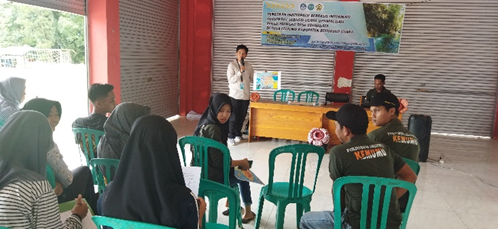
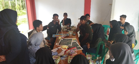
The initiative’s success relies on its procedural phases: preparation, implementation, and evaluation. The preparation phase includes acquiring necessary tools and materials. Implementation involves engaging the community in mapping activities using the prepared tools. Finally, evaluation serves as a platform for sharing outcomes and planning future actions.
This project yielded positive results. It increased community involvement in edu-tourism development by educating them about geospatial information and participatory mapping. Additionally, it led to better decision-making by providing comprehensive data on local attractions, amenities, and accessibility.
The success is evident in the evaluation data, which highlights the community’s enthusiasm for the initiative. With 67% expressing strong agreement, the project’s impact is undeniable. This endeavor exemplifies how geospatial information, when combined with community engagement, can foster sustainable rural tourism and contribute to local economic growth.
As Desa Kemumu paves the way for a brighter future, it demonstrates the potential of participatory mapping to guide development while preserving natural beauty and cultural heritage. This initiative showcases how geospatial technology can be a driving force in shaping a community’s destiny.
News contributor: Akbar Abdurrahman Mahfudz


